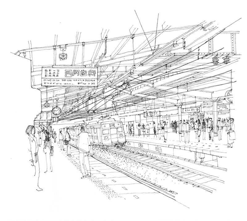
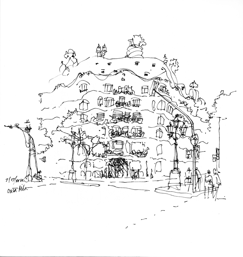
More examples of how changes in media affect not how one sees, but rather how one captures what is seen—the pace of the line, the level and precision of detail, and the voids that speak to the eye.
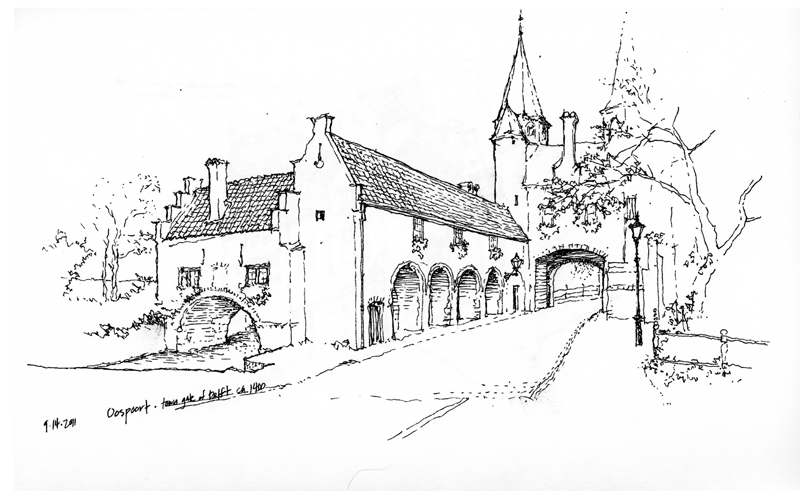

More examples of how changes in media affect not how one sees, but rather how one captures what is seen—the pace of the line, the level and precision of detail, and the voids that speak to the eye.
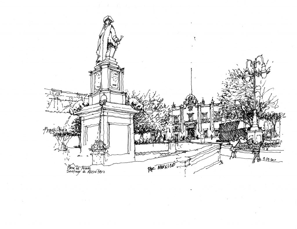 Here is a view of Plaza de Armas, also known as the Plaza de Independencia, in Querétaro. In the foreground is a fountain with a statue of Juan Antonio de Urrutia y Arana, who was responsible for the construction of a 4200-foot long aqueduct to bring water to the city from La Cañada in the early 18th century. He is looking toward the Palacio de la Corregidora, residence of Don Miguel Domínguez and his wife Josefa Ortiz de Domínguez, who is revered for her role in liberating Mexico from Spain. The palace is now the seat of the state government of Querétaro.

Along the west side of the plaza is this view corridor, with a carefully pruned mass of Indian laurel trees on the left and on the right, the Casa de Ecala, an 18th-century baroque mansion named after Tomás López de Ecala. The casa is now home of DIF (Desarrollo Integral de La Familia), a state agency offering social assistance to Mexican families.
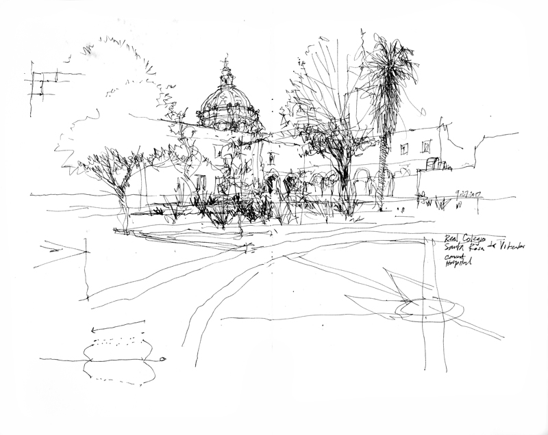
 The public enters the 1752 Church of Santa Rosa de Viterbo through twin entrances on the north side rather than the more typical west end, which abuts a busy street. This view is drawn from the Plaza Mariano de las Casas, created in 1964 to increase the visibility of this north side of the church.
Santa Rosa de Viterbo was originally associated with a convent whose nuns devoted themselves to primary education. After the convent was closed in 1861 due to the Reform Laws, the facility was transformed into a hospital. Today, the convent portion is the Centro de Estudios de Diseño y Artes Graficas Mexico-Italiano.

We often are enthralled with monuments and monumental buildings and do not pay enough attention to the uniqueness and beauty of the more mundane places we encounter. Here are a couple of views of the commonplace. The first is the short pedestrian-only Calle V. Carranza, in the historic center of Querétaro. At the east end of the narrow street stands a bust of Venustiano Carranza Garza (1859–1920), the first elected president of the newly formed Mexican Republic in 1917, after the Mexican Revolution of 1910, and under whose watch the 1917 Constitution was ratified.

The second view illustrates the power of a simple line drawing to capture a scene—this one a table at Maria y su Bici, a Oaxacan mezcaleria in Querétaro.
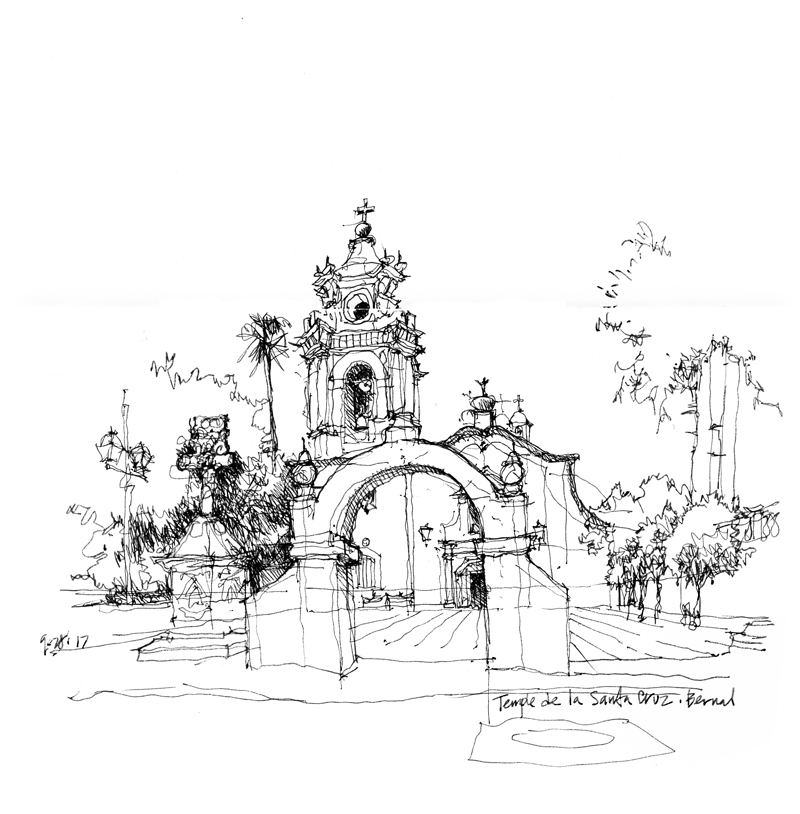
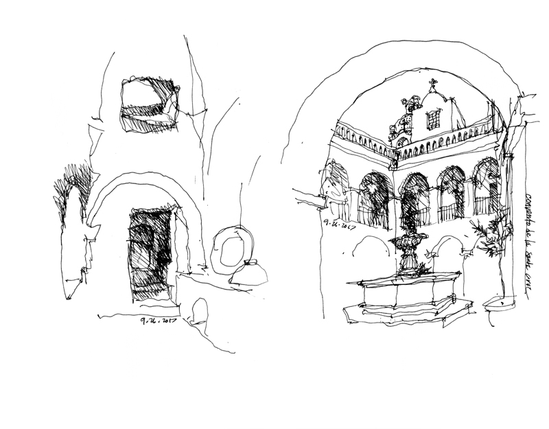
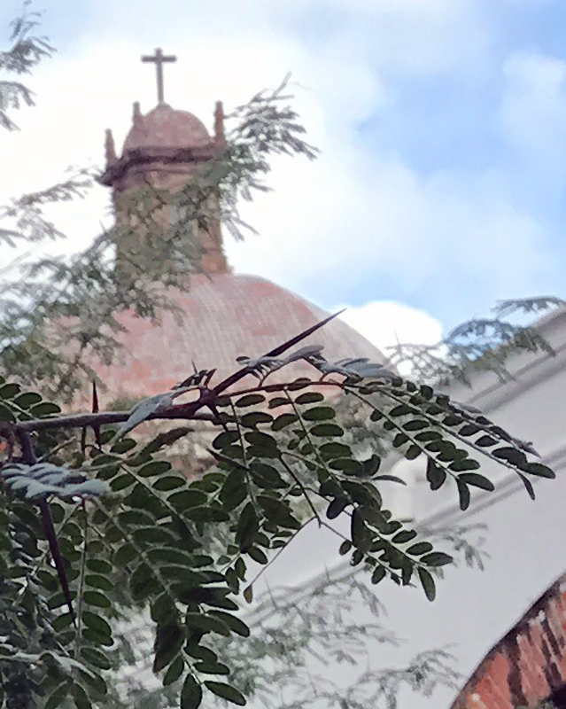
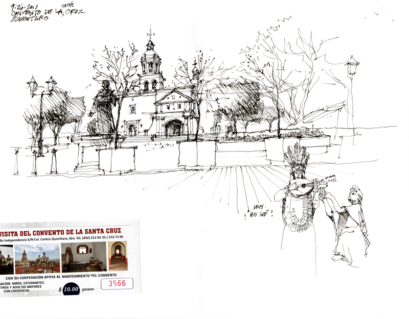 The Franciscan Church and Monastery of Santa Cruz (Iglesia y Convento de la Santa Cruz) dates from the 16th century and is named for the pink stone cross on the main altar. This cross commemorates the appearance of St. James that was supposed to have occurred on July 25, 1531 as the Spanish and their Nahuan allies battled the Otomi and Chichimecas on the hill where the church and monastery are now located. The well preserved compound consists of a series of cloisters and monk’s cells, along with a kitchen, orchard, water reservoir, and related ancillary facilities.
The first missionary school in the Americas, the School for the Propagation of the Faith (Colegio de la Propagación de la Fe) was established here. From this school, Franciscan friars ventured forth to establish missions as far north as what is now Texas and California.
In one of the courtyards is a thorn tree which, according to legend, grew from the walking stick that the missionary Fray Antonio Margil de Jesús stuck in the ground during his stay at the monastery. What is notable is that the tree bears thorns having three spines in the shape of a cross.
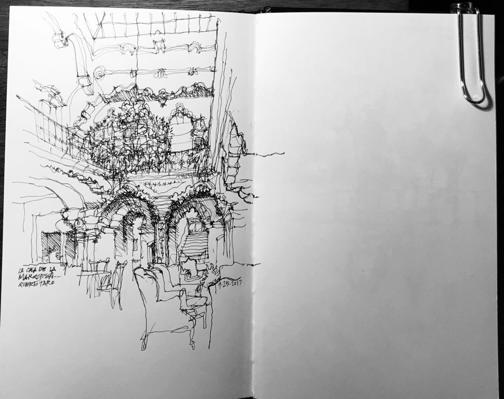
I’ve spent a week in Santiago de Querétaro, a UNESCO World Heritage Site, exploring the historic center and drawing with a wonderful group of students from the School of Architecture, Art and Design at Tecnologico de Monterrey. At the end of the first day’s activities, as I was walking back to my hotel, this casa was pointed out to me. It was built in 1756 for the Marquesa de Villar and is now a boutique hotel. Seeing the richness of the entry court, I felt compelled to draw to stop and draw it. More drawings to come.
Earlier this week, I spent three days in Indianapolis to participate in a video project for my publisher Wiley. On the first day, we drove down to Columbus, Indiana, for some on-location sketching. Here are a couple of quick sketches that I did as studies before I attempted the larger format drawings that were to be filmed.
Columbus is known for its collection of Modernist projects that are interspersed among the town’s older 19th-century buildings. This unusual architectural heritage owes its existence to J. Irwin Miller who, as president and chairman of Cummins Engine Company, created the Cummins Foundation in the mid-1950s to subsidize projects by Eero Saarinen, I.M. Pei, S.O.M., Cesar Pelli, Richard Meier, and Robert Venturi, among others.
Thanks to Lauren, LIsa, Paul, and Eric for their expert assistance in making this project possible, and to the Ball State University students who participated in the studio sessions.
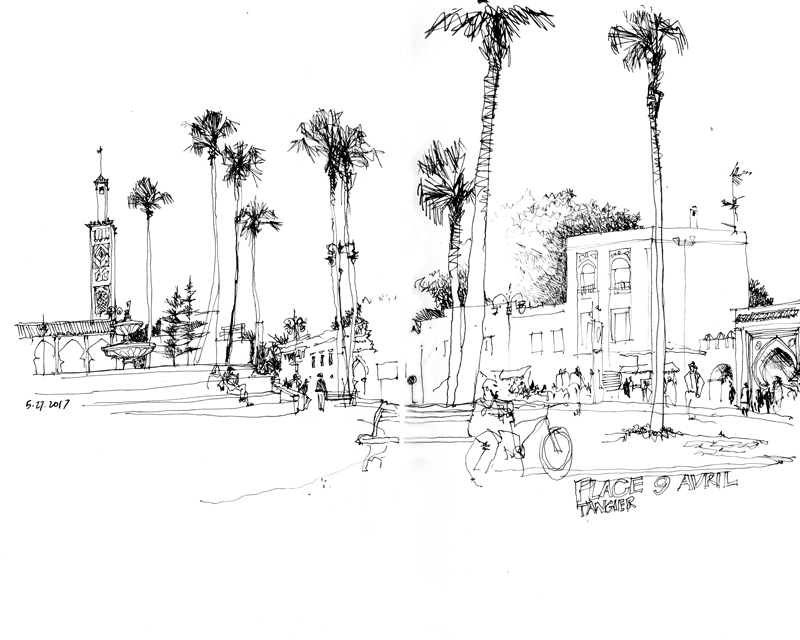
This is a view of Place du Grand 9 Avril 1947, also known as Grand Socco (Big Square), just outside one of the gates to the médina of Tangier. The square is named after the speech Mohmamed V gave in support of Moroccan independence on April 9, 1947. Normally the space is filled with street performers and vendors selling a variety of fruits, spices, and second-hand goods but it was somewhat quiet due to the beginning of the observance of Ramadan—the annual holy month of praying and fasting for Muslims worldwide
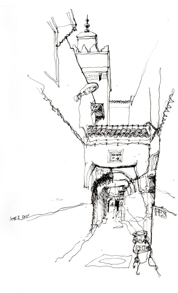
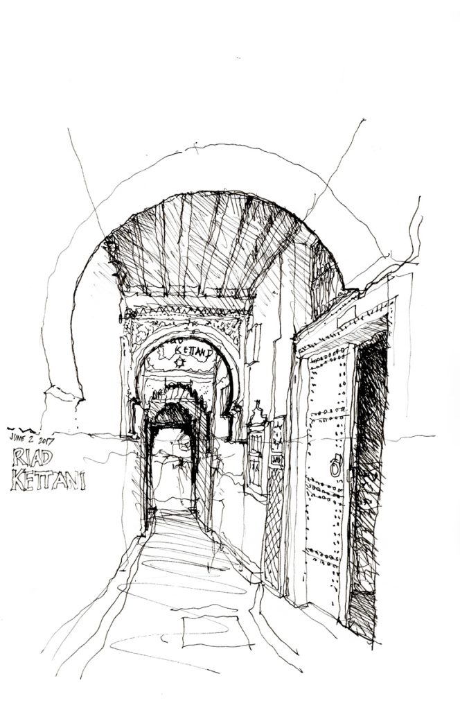
The Médina of Fès is one of the largest car-free urban zones in the world and through its pathways people and goods flow like the blood coursing through our arteries and veins. Because of their narrowness, it seems awkward to call these pathways “streets” although that is how they function. In addition to serving as paths for people and conduits for goods carried by handcart or donkey, these “streets” serve as informal social spaces and as extensions of small commercial establishments.
There are generally three scales, ranging from main streets as seen in the first image above, to side streets, and finally to back streets as narrow as a meter wide as seen in the images below.
This post is not about drawing. Rather, it concerns the issue of scale—the relative sizes of things and how we perceive this comparison—which is relevant to both drawing and design.
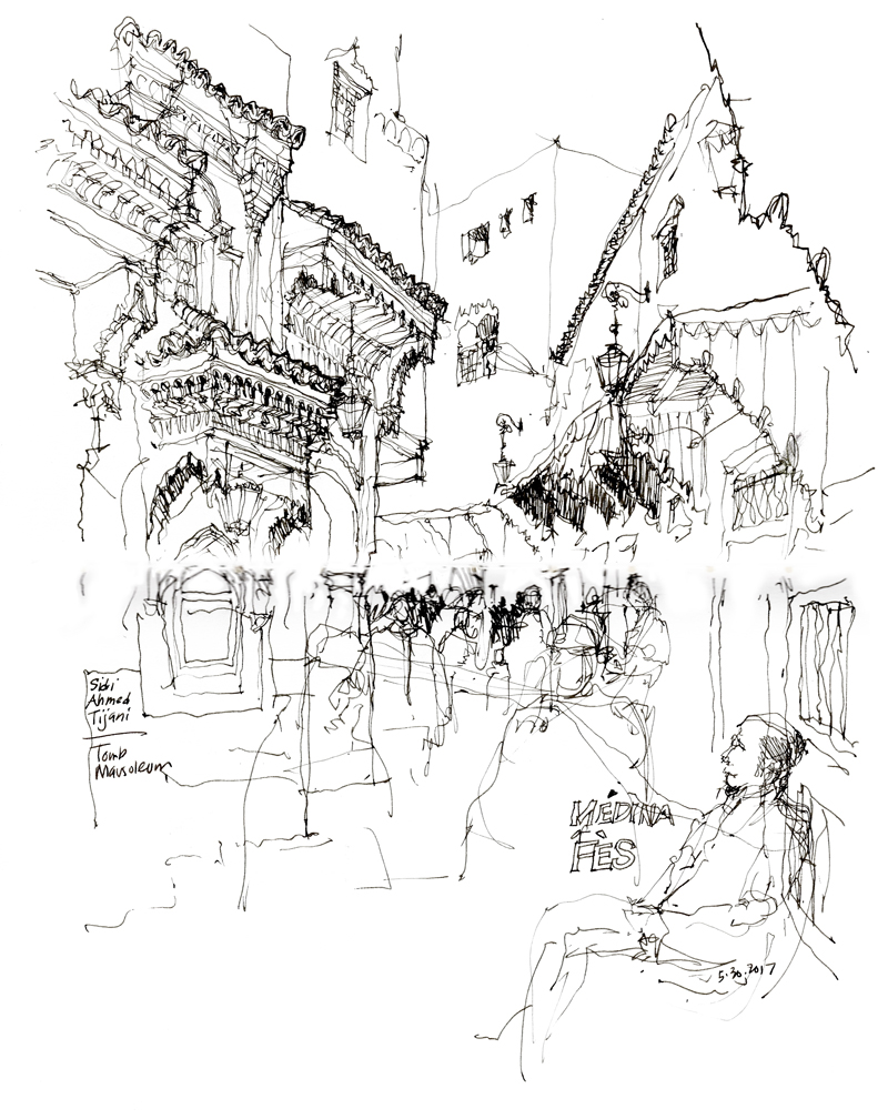
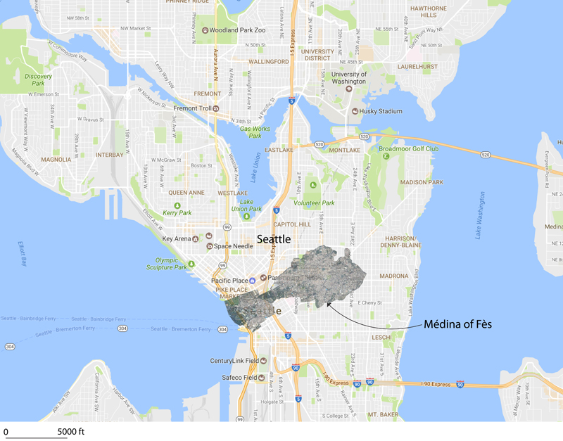
The historic core of the Médina of Fès, Fes el Bali, was founded in the late 9th century as the capital of the Idrisid Dynasty. The médina is full of souks and artisans working in leather, copper, brass, wood, textiles, and ceramics, and is home to historic mosques, mausoleums, and madrasas, as well as Al-Karaouine, founded in 859 and considered to be the oldest continuously operating university in the world. Markets line its car-free streets and sell all manner of herbs, spices, fruits, and vegetables. Declared a UNESCO World Heritage Site in 1981, the Médina of Fès remains to this day a medieval town in layout and scale, with a dense, low-rise building fabric, and narrow streets.
Returning home to Seattle from Fès, I find it difficult to convey the differences in scale and density of the two urban environments. Above, I overlaid (I hope accurately) the plan of the Médina of Fès atop a map of a portion of Seattle to indicate their relative sizes. What cannot be seen, however, are the relative population densities of the two urban areas. That of Seattle is around 6,800/square mile while that of the Médina is roughy 70,000/square mile. Even if my calculations are off by a little, that is a significant difference in scale that is difficult to understand without actually experiencing it.